Google Maps turns 15: How the popular navigation app has evolved over the years
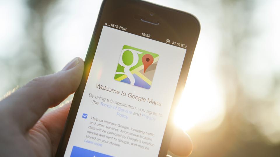
Google Maps, which is one of the most popular navigation apps in the world, has turned 15 today. That’s 15 years of being used on both Android and Apple smartphones across the globe for a variety of purposes ranging from finding new addresses to finding new diners to exploring new places.

How many times have you turned to Google Maps for help when you were unsure of which metro station was closest to your destination?
How many times have you asked Google Maps to lead the way to that new restaurant that everyone has been talking about?
Google Maps, which is one of the most popular navigation apps in the world, has turned 15 today. That's 15 years of being used on both Android and Apple smartphones across the globe for a variety of purposes ranging from finding new addresses to finding new diners to exploring new places.
But Google Maps was not as savvy and as adept 15 years ago, obviously. A lot has changed over all these years. And on its 15th birthday, we take a look back.
Back in time
At the time Google launched Maps back in 2005 on February 8, it wasn't even available on phones. We are saying 'phones' and not 'smartphones' because it wasn't until Apple launched the iPhone in January 2007 that smartphones became a mainstream device.
Sure there were phones from Nokia, BlackBerry and Motorola that had some of the functionalities that we see on smartphones these days, but these cool devices were limited to a niche audience.
Humble Beginnings
In February 2005, when Google Maps was launched, it was just a desktop-based site that was designed to help people get from point A to point B.
"We think maps can be useful and fun, so we've designed Google Maps to simplify how you get from point A to point B," Google had written its short and succinct blog post.
Of course, users could get directions to reach their destination and they could see alternative routes for their journey by magnifying the map, but that's just it. There was nothing more that the website could do.
Then in June 2005, Google acquired Keyhole EarthViewer and launched Google Earth - a 3D map of our home planet that you could zoom in to see some great details.
The Google Maps website got better in February 2007 when Google added real-time traffic support to Maps enabling users to check traffic conditions on their route.
Hello smartphones
Google Maps achieved one of its biggest and most important milestones when it transitioned from being a desktop-only platform to being available on PCs and smartphones in November 2007.
"The application is now available on and optimized for a wide variety of platforms, running on most J2ME-enabled devices; all color BlackBerry devices; Windows Mobile devices with Windows Mobile 2003, 5.0, and above; Symbian Series 60 3rd Edition devices; and Palm devices with Palm OS 5 and above," Google wrote in its blog at the time.
This release also included a My Location feature that used a complicated lot of data including GPS data, cell towers and wireless networks to determine a user's location.
This transition was a big step and it meant that people with smartphones could use their devices to navigate around a city.
Almost a year later in September 2008, Google Maps arrived on the Android operating system. And a year later, in October 2009, the company introduced turn-by-turn navigation in the app.
Going beyond roads
In 2012, the Google Maps introduced the Street View Trekker. This feature enabled the company to chart mountains, valleys and other areas where wheels couldn't chart. As a part of the program, the company clicked high resolution images and coupled those with existing information to improve the accuracy of Maps.
The same year, Google Maps also arrived in 10 more countries including Australia, Switzerland and Norway.
Two years later, Google introduced 'Google My Business' functionality that made it easier for users to find specific shops and restaurants and other businesses around them. Essentially, it allowed people to explore places better. This is also the feature that allows you to find the best cake shops near your house, so you know what exactly to be thankful for.
Also Read: Google CEO Sundar Pichai shares his favourite places in Google Maps
Getting smarter
Another big moment for Google Maps was in November 2015 when they introduced the offline mode. This feature enabled users to get step-by-step directions to their destination along with relevant information even when there is no Internet connectivity.
In the same month, Google also introduced its Local Guides program that allowed the company to partner with users to get feedback and reviews about places around the world. Google says that nearly 120 million users are currently contributing to the program now.
Also Read: Google Maps turns 15: Here are all the Maps features that show Google's love for India
Now and the way forward
In 2019 the company introduced the Live View feature that used Augmented Reality to direct users to their destination. This feature is currently still in beta mode and will be officially rolled out to all users in Match 2020.
Over the years, Google has added dozens of features - Bus Travel Time, Auto-rickshaw mode, mixed mode travel), wheelchair accessibility etc - to make it easier for users across the world to navigate through their worlds with ease no matter what the topography and travel conditions.
So, what's next? Google plans to use artificial intelligence (AI) and machine learning to improve on the quality of the maps and add newer features. We'll have to wait and watch what the next 15 years can do.
Catch all the Latest Tech News, Mobile News, Laptop News, Gaming news, Wearables News , How To News, also keep up with us on Whatsapp channel,Twitter, Facebook, Google News, and Instagram. For our latest videos, subscribe to our YouTube channel.


