Republic Day traffic restrictions: Use Google Maps to avoid traffic, Here’s how | Tech News

Republic Day traffic restrictions: Use Google Maps to avoid traffic, Here’s how

Republic Day traffic restrictions: Google Maps can be of help to avoid road blockades and traffic. Here’s how to do it.
By: HT TECH
| Updated on: Aug 21 2022, 23:49 IST
Republic Day
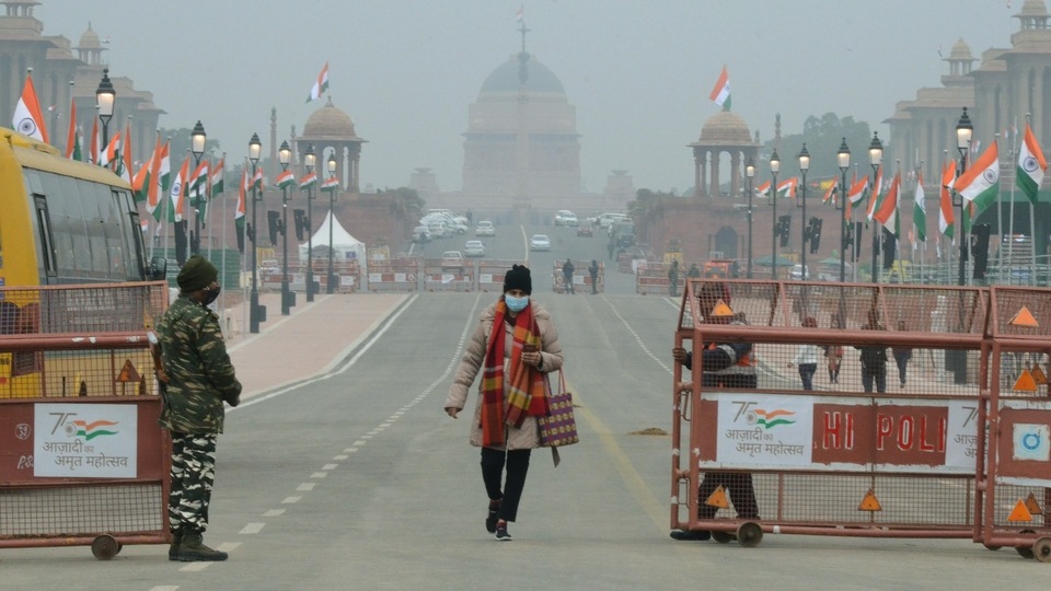
Republic Day traffic restrictions: Google Maps can help you plot route to avoid Republic Day traffic snarls. (Sanjay Sharma / ANI)

Republic Day traffic restrictions: If you are residing in Delhi or most state capitals where Republic Day celebrations are going to happen on a large scale, this story is for you. In New Delhi, the grand scale celebrations of Republic Day will take place on the Raj Path and as a measure of security, most roads leading to, or around the areas will be blocked. As a result, the traffic flow could be disrupted and if you have plans to stay out, it does not spell good for you.

Hence, in situations like these, you can simply rely on Google Maps to get you through.  It is the most highly used map system in the country and with large number of live datapoints available for cabs and other vehicles on the road, Maps can give you a near-accurate representation of the actual traffic conditions. 

You may be interested in

MobilesTablets Laptops
37% OFF
Google Pixel 7 Pro 5G
  • Obsidian
  • 12 GB RAM
  • 128 GB Storage
37% OFF
Google Pixel 2 128GB
  • Kinda Blue
  • 4 GB RAM
  • 128 GB Storage
7% OFF
Google Pixel 7 5G
  • Obsidian
  • 8 GB RAM
  • 128 GB Storage
11% OFF
Google Pixel 7A
  • Charcoal
  • 8 GB RAM
  • 128 GB Storage

Hence, if you are heading out, keep your phone's battery fully charged and go around traffic on Republic Day with ease. If you want to know how you can track live traffic updates on Google maps and avoid it.

Also read
Looking for a smartphone? To check mobile finder click here.

How to use Google Maps to avoid traffic

Step 1: Open the Google Maps app on your Android and iPhone smartphone.
Step 2: Next, look for the overlay to enable the traffic view. This overlay can be found on the corner of the map window and looks like a couple of stacked squares.
Step 3: Tap on it and under the “Map Details” section, you will find the “Traffic” option.
Step 4: Once you do this, the map will now show all the traffic data on the map. If you see streets in green, that means the road is safe to take and you won’t face any heavy traffic. Streets in yellow and orange show increasing levels of traffic in those routes. If you see red, it is better to avoid that road since that represents stopped cars.
Step 5: Additionally, check with the latest updates from local authorities about road closures around the India Gate area. Some roads will be inaccessible to the public until the parade is completed.

Catch all the Latest Tech News, Mobile News, Laptop News, Gaming news, Wearables News , How To News, also keep up with us on Whatsapp channel,Twitter, Facebook, Google News, and Instagram. For our latest videos, subscribe to our YouTube channel.

First Published Date: 25 Jan, 17:41 IST
Tags:
NEXT ARTICLE BEGINS
Not sure which Mobile to buy? Need help?