These photos of Earth are STUNNING! Check out these pics shared by European Space Agency
ESA posed these stunning pictures of Earth on their social media handles. Check them out below.
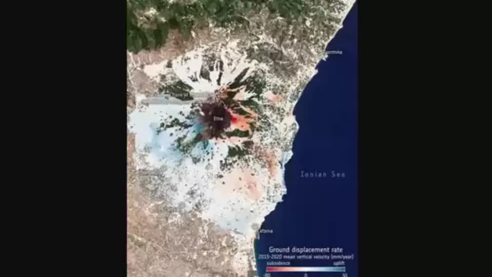
European Space Agency (ESA) shared some “You've never seen Earth like this” images of various places on Earth on August 1.
The images were captured by ESA's environmental Copernicus program via the Sentinel-1 radar satellite mission, which is freely accessible by the public. The images were taken as a part of the initiative to collect the ground displacement rate data. Mount Etna on the east coast of Sicily, Italy, can be seen in one of the images. According to ESA, the eastern flank of Mount Etna subsided by 80mm per year on average.
The other places captured included Bologna, also in Italy and Larissa in Greece.
ESA wrote below the image, “any movement beneath our feet – from barely perceptible subsidence to the sudden appearance of a sinkhole or a crashing landslide – spells big trouble. Even relatively modest subsidence can weaken buildings and infrastructure and lead to issues such as flooding, and at worst the abrupt disappearance of sections of land brings immediate threat to life. Monitoring and predicting our shifting land is clearly essential for adopting mitigating strategies.”
“And now, thanks to Europe's environmental Copernicus programme and the Sentinel-1 radar satellite mission, the first Europe-wide subsidence and soil movement analysis service is available to the public free and accessible.”
They further added, “The images here are examples of data that can be accessed through the service. They depict ground motion around Mount Etna and Bologna in Italy, as well as an area around Larissa in Greece. While subsidence and uplift around Mount Etna is linked to volcanic activity, the subsidence we see in Bologna and villages near Larissa is associated with the extraction of groundwater.”
“In fact, among the most important and valuable applications of this new service is for risk assessments related to geohazards. Risk assessment through ground motion analyses is essential for the development of mitigation strategies and for more effective exploitation of resources, as well as for better management and planning of urban areas and infrastructures,” they wrote at the end.
Catch all the Latest Tech News, Mobile News, Laptop News, Gaming news, Wearables News , How To News, also keep up with us on Whatsapp channel,Twitter, Facebook, Google News, and Instagram. For our latest videos, subscribe to our YouTube channel.


