‘Beep! You missed that turn’
A GPS receiver can tell you exactly where you are, anywhere on the planet. Prasanto K Roy tries out one of the GPS units...
Turn right in 100 meters," the Voice urged me. I drove on. "Turn right now!" it insisted. I looked, and there was a road there, but also a high divider in the way. I drove past. "Turn right and back in 600 meters," the Voice persisted.
The Voice came from my windscreen. I was trying out a GPS unit from Delphi and MapmyIndia.
And I was sampling the challenges of mapping a country in constant flux, where new buildings come up, roads change, and dividers get broken and rebuilt, every day.
A GPS receiver can tell you exactly where you are, anywhere on the planet. Using radio signals from satellites, it calculates its exact position and altitude. To avoid showing you a mass of numbers, most devices use maps, telling you "you are here" on a map.
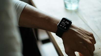
The map is the key to using GPS, and it was the missing component all these years. India's cities were not mapped in enough detail. You could buy a Garmin GPS for a few hundred dollars from the US, but you'd get only US and EU maps. I got a watch with built in GPS - but without maps, it was a fun toy.
GPS is now cheap, and it's built into phones. As with other consumer tech like MP3 and digital cameras, this lets it reach millions of people, who would otherwise not have bought a GPS device.
Before a recent trip to Hyderabad, I'd looked up my cousin's new house on Google Maps, and marked the spot on my phone. I don't know the city at all. I then forgot about it. Until I got a cab driver from the airport who didn't know the city either.
And then it started pouring. We were driving blind. I took out my phone, and directed the driver all the way. When the dots met, I got down in pouring rain and stepped into the gate across the car door - and it was, of course, the right house.
Calling Planet Earth
GPS is the global positioning system, a network of over 24 satellites managed by the US Air Force. Each satellite has an atomic clock, and transmits a radio signal to earth.
A GPS receiver gets the signal from several satellites, compares them, and works out where it is on the planet down to a few meters - latitude, longitude, and altitude. It also knows the time - the exact time.
GPS was once the preserve of the US military, and was famously used in Desert Storm to track soldiers and assets. Then, in 1983, the Russians shot down a Korean airliner that had got lost… it had strayed into USSR airspace. Soon after that, the Reagan administration decided to make GPS available for civilian use. The USA's 911 emergency service now uses information from GPS-equipped phones to instantly get location details. That decision changed aviation and maritime navigation.
GPS then got into consumer devices, including handhelds, and in this decade, into mobile phones.
GPS is now embedded into other devices too. A digital camera with GPS will 'geotag' your photos - stamp them with not just date and time, but also the exact location! (You could then simply search for all photos of your vacation in Kerala or Kasauli - in one shot.)
Find your way - free
You don't have to blow up ₹25,000 on a GPS receiver to find out where you are. All you need is a phone with a data service such as GPRS. (That sounds like GPS, but is different - it's 'gateway packet radio service'.)
It's easy if you have GPS built in (dozens of phones at ₹15,000 upward do: Apple's iPhone, Nokia's Navigator, N95, E71, etc, and models from Samsung, BlackBerry, Sony Ericsson, Motorola, HTC and others). You'll find some maps software installed. If not, download Google Maps on your phone from m.google.com.
If you don't have GPS, you have two options. You can buy a GPS adaptor, which tells your phone the location, over a bluetooth connection, and you can load Google or Yahoo Maps or other software. I use a $90 Nokia GPS with my E51, and third-party adaptors are cheaper.
Or, don't buy anything. The free Google Maps software has a 'my location' feature that uses information from mobile towers to tell you roughly where you are, within a mile or so. Just install and run the software. Press 0 for your location. You'll see a blue dot with your rough position.
You might also find other software on your phone that uses GPS. For instance, the Nokia E-series phones have a tool that tells you your exact speed, distance covered, average speed, direction, and more.
Of course, you get only basic maps and location info on your phone. A full-fledged GPS for your car ( ₹20-25k) would give you routes and turn by turn instruction, voice-prompts, and more.
You can expect to see - and use - a lot more of GPS in 2009, in your phone - and in other devices.
Prasanto K Roy ( pkr@cybermedia.co.in ) is chief editor at CyberMedia, which publishes 15 specialty titles such as Dataquest and Living Digital
Catch all the Latest Tech News, Mobile News, Laptop News, Gaming news, Wearables News , How To News, also keep up with us on Whatsapp channel,Twitter, Facebook, Google News, and Instagram. For our latest videos, subscribe to our YouTube channel.

